
Fort Lauderdale Land Surveying: What Equipment Do Surveyors Use and Why It Matters
If you’ve ever noticed a surveyor setting up tripods, poles, and electronic instruments around a property or construction site in Fort Lauderdale, you may have wondered: what are all these tools for?
Land surveying is far more than measuring distances. Professional surveyors use advanced technology to capture precise property boundaries, elevations, and construction layouts. These measurements are essential for property sales, building permits, flood compliance, and any construction project in Fort Lauderdale.
Knowing what equipment surveyors use—and why it matters—can help you understand the value of a professional survey and how it protects your property investment.
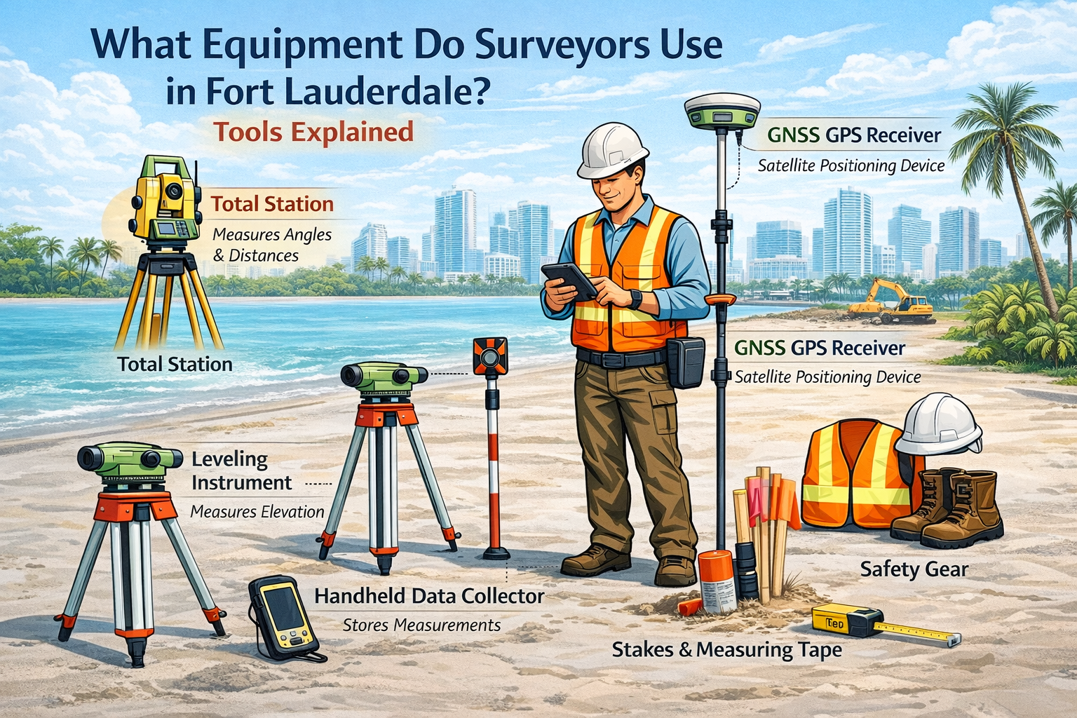
Essential Surveying Equipment in Fort Lauderdale
Surveyors rely on a combination of high-tech instruments and traditional tools to ensure accuracy. Here’s what you’ll see on most Fort Lauderdale job sites:
1. Total Station
A tripod-mounted device resembling a small telescope.
Purpose: Measures angles and distances with extreme precision.
Uses: Property boundary surveys, construction layouts, topographic mapping, and site planning.
2. GNSS / GPS Receiver
A satellite-based device that determines exact geographic positions.
Purpose: Provides centimeter-level accuracy for large or complex sites.
Uses: Subdivision surveys, infrastructure projects, and establishing survey control points.
3. Leveling Instrument
A precision tool that measures elevation differences between points.
Importance in Fort Lauderdale: Critical for flood zone compliance, drainage planning, and construction grading.
4. Prism Pole / Reflector
A tall pole with a reflective prism used with a total station.
Purpose: Allows surveyors to measure distances accurately across a property.
Uses: Marking property corners, locating structures, and mapping terrain.
5. Measuring Tape and Survey Stakes
Traditional tools still essential for short distances and site marking.
Uses: Property corners, construction reference points, and utility locations.
6. Handheld Data Collector
A rugged device that stores measurements digitally.
Benefits: Quick field data entry, seamless integration with drafting software, and accurate survey reports.
7. Safety Gear
Surveyors work near traffic, water, and construction equipment, so protective equipment is mandatory:
Hard hats, reflective vests, work boots, gloves
Why Fort Lauderdale Property Owners Need Professional Surveys
Professional land surveys offer accuracy, compliance, and peace of mind:
Prevent Property Disputes: Clearly define boundaries to avoid conflicts.
Ensure Construction Accuracy: Place buildings and additions in the correct locations.
Permit Compliance: Many Fort Lauderdale permits require boundary, elevation, or construction stakeout surveys.
Flood Zone Protection: Accurate elevation data supports FEMA and insurance requirements.
Save Money & Time: Avoid costly mistakes, legal issues, and construction delays.
Get Your Fort Lauderdale Land Survey Today
Whether you’re buying property, building a new home, or developing commercial land in Fort Lauderdale, our expert surveying team delivers accurate, reliable, and timely results.
✅ Request Your Survey Today – Don’t risk errors or delays. Contact us to schedule a consultation or get a free quote.